Lesson of the Day 33: Land and Water Forms — A Geography Adventure
Published on: April 10, 2026
Land and Water Forms — A Geography Adventure
...l, l, l the land sound, L makes a landscape sound!
Anytime of the year is a good time to study geography! During your summer trips, point out different landforms on a map and look for them as you travel — it's a fun road game. Geography is the study of how humans interact with their physical environment, including the features of the planet, animals, plants, and cultures. A child's first introduction to geography starts in the home, and an important part of their education is learning about other cultures and environments.
Recommended Materials
- Elite Montessori Sandpaper Land & Water Form Cards — 10 wooden cards with textured surfaces illustrating bay-cape, strait-isthmus, archipelago-chain of lakes, peninsula-gulf, and island-lake. Children feel the difference between land (rough) and water (smooth).
- Kghios Land & Water Form Cards Set — Montessori geography educational tools with 10 different terrain forms for preschool and home learning.
Free Printouts
This lesson includes 7 free printable resources organized in three sets:
Set 1 — Basic Landforms (Peninsula, Bay, Lake, Island, Isthmus, Strait):
Set 2 — Terrain Landforms (Mountain, Hill, Plateau, Plain, Valley):
Set 3 — Large Landforms (Ocean, Land, Continents, Layers of Earth):
Name Labels (for all sets):
What Are Landforms?
A landform is a unit that forms part of the overall shape of the earth. A collection of landforms is called a landscape — all the visible parts of an area of the earth.
Terrain Landforms
- Mountain — An area of land that's drastically higher than the surrounding area, with a distinct summit (top)
- Hill — An area of land that's somewhat higher than the surrounding land, without needing a distinct summit
- Plateau — An area of land that is relatively flat and elevated above the surrounding land
- Plain — A flat area of land, generally near rivers
- Valley — A low-lying area of land surrounded by mountains, hills, or plateaus
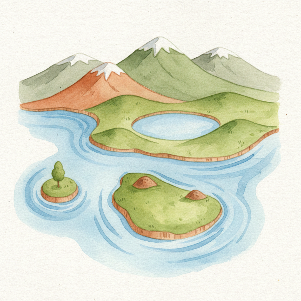
Land and Water Forms (Pairs)
One of the most elegant aspects of Montessori geography is teaching land and water forms in pairs — each landform has a water counterpart:
- Peninsula — An area of land surrounded on three sides by water
Bay — An area of water surrounded on three sides by land - Island — An area of land smaller than a continent, surrounded by water on all sides
Lake — A body of fresh water that is relatively still - Isthmus — A narrow piece of land connecting two larger bodies of land
Strait — A narrow body of water connecting two larger bodies of water
Notice the beautiful symmetry: a peninsula is to land what a bay is to water. An island is to land what a lake is to water!
Large Landforms
- Ocean — The salty water that covers most of the Earth's surface
- Land — Dry land surrounded by the oceans
- Continents — Land is broken up into seven continents
- Layers of Earth — The Earth is made up of three solid layers: the core (solid center with liquid outer core), the mantle (mostly liquid), and the crust (the thinnest layer — we live on the surface of the crust, and all the continental plates are made of crust). Above the crust is the atmosphere.
How to Use the Nomenclature Cards
The three-period lesson works beautifully with these geography cards:
- Presentation: Place a picture card (such as the isthmus) on a work rug or table. Place the word label "isthmus" below the picture. Under the card and label, place the definition card.
- Read the definition to your child: "An isthmus is a narrow neck or strip of land where two larger sections of land are connected."
- Add two more cards, placing them in proper order — one card, label, and definition at a time.
- Let your child take over after demonstrating. Stop your presentation when your child understands and wants to continue independently.
This lesson can stretch over several days — there's no need to learn all the landforms at once!
Activity: Land and Water Form Modeling
Make the geography concrete by building landforms with clay or playdough!
What you need:
- Blue and brown/green playdough or clay
- A shallow tray or plate
- Water (optional, for dramatic effect)
Activity:
- Use brown clay to form a peninsula — shape the land so it sticks out into the "water" (blue clay or actual water)
- Now flip the concept: use brown clay to surround blue clay on three sides to make a bay
- Make an island (brown surrounded by blue) and a lake (blue surrounded by brown)
- Make an isthmus (narrow brown strip connecting two brown areas) and a strait (narrow blue channel connecting two blue areas)
Children love seeing how each land form has a water form pair. The hands-on modeling makes abstract geography concepts concrete and memorable.
Road Trip Geography Game
Turn any car ride into a geography lesson! Before your trip, look at a map together and identify landforms you might see along the way. During the drive, children can check off each landform they spot:
- Did we cross a valley?
- Can you see a mountain in the distance?
- Did we drive over a plain?
- Is that a lake or a bay?
See also: Lesson 30: Space and Geography for latitude, longitude, and coordinate games, and Lesson 28: Earth Science for plate tectonics and the forces that create these landforms.
Disclosure: Some links on this page are affiliate links. As an Amazon Associate, MontessoriMom earns from qualifying purchases. This costs you nothing extra.